
Skip to content
Plan my trip

Mountain days and walking bases

A ride above Sarajevo, a village-start walk on Bjelašnica and a full Čvrsnica mountain day are different outings. Trebević, Igman, Jahorina and Visočica give a Sarajevo stay several possibilities; Blidinje, Vlašić, Kozara and Sutjeska deserve their own route and return plans.

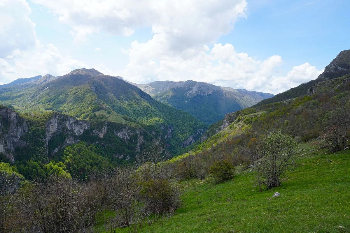
The landscape towards Rakitnica Canyon from Studeni Polje near Umoljani

Trebević: a lift above Sarajevo

From Bistrik, Trebević’s cable car takes you above Sarajevo, where the Olympic bobsleigh track is one of the visitor interests. A ride and a chosen walk suit a different day from the climb on foot. Plan the walking route and descent together.

The operator lists Monday–Wednesday as closed and 09:00–19:00 on the other days. Use its selected-day information for the visit and final descent; a weather closure can change both the outing and the return.

Umoljani: Studen potok or Lukomir?

Via Dinarica publishes the Umoljani–Gradina–Studen potok return at 9.5 km with 306 m of cumulative ascent. It gives the day a stream-valley and village focus. Compare those figures with the group’s walking experience.

The Lukomir loop is longer: 15.1 km and 782 m of cumulative ascent. The published route crosses Oblj and returns above Rakitnica towards Studen potok and Umoljani. Allow a full day for the Lukomir walk.
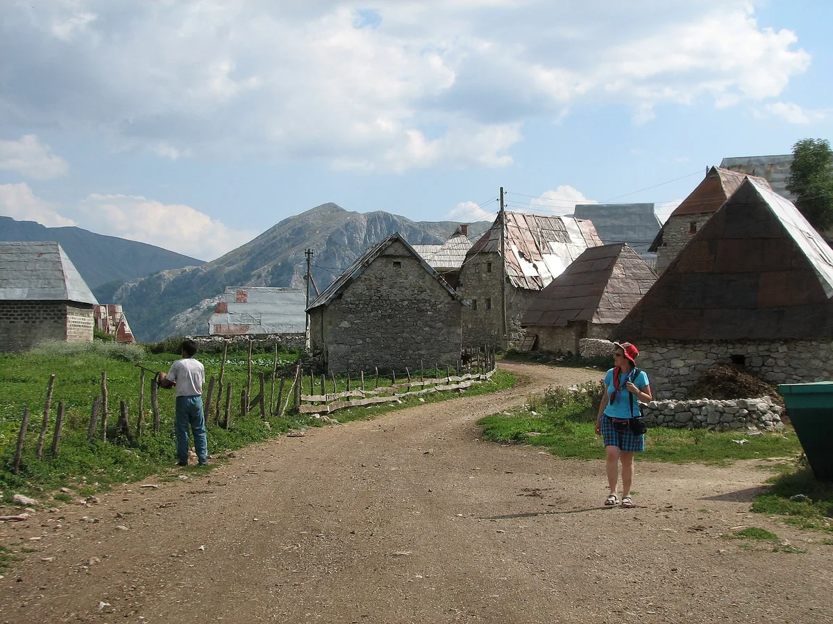
Stone houses in the highland village of Lukomir
Stone houses in the highland village of Lukomir Photo: NH53

Kozara: a circuit or a different endpoint

Mrakovica’s 3.4 km circuit can accompany a Kozara memorial visit. The 9 km route via Kozarački kamen is one way, finishing at Rajkovići. If the car stays at Mrakovica, arrange the return before choosing the longer walk.

Use the Kozara guide to put the memorial, a short circuit or a longer woodland day at the centre of the visit.

Blidinje: lower landscape walks or a summit

For Blidinje, the local tourism association publishes a 6.5 km Masna Luka walk with about 200 m of height difference, and a 10 km lake circuit with about 30 m. These are differences in height, rather than cumulative ascent. Choose Masna Luka for its landscape or the circuit for a day centred on the lake.

Vran, Čvrsnica and Hajdučka vrata need a separate mountain itinerary, suitable conditions and a leader’s route assessment. For a shorter heritage day, the Blidinje guide also places Dugo polje’s medieval stones on the plateau.

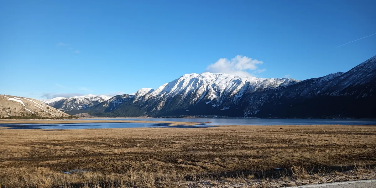
Blidinje Lake and the surrounding mountains
Blidinje Lake and the surrounding mountains Photo: Hienstorfer

Sutjeska: the approach is part of the outing

Dragoš sedlo, Prijevor and Donje Bare give Sutjeska different viewpoint and lake outings. The mountain-road approach determines the time left for walking. Name the destination and route when discussing transport, especially for a Maglić ascent or a journey towards an international boundary.

The park’s difficult four-lake Zelengora itinerary takes about 9–10 hours overall, including 5–6 hours walking. Entry inside Perućica requires advance approval and accompaniment by authorised park staff. The Sutjeska guide keeps that protected-forest visit separate from a memorial or viewpoint day.

Give the mountain day a workable return

Landmines and unexploded ordnance remain a rural and mountain risk. Use an experienced local guide beyond roads and paved areas, keep to the agreed route and avoid shortcuts. For a village-start walk or cable-car outing, save the actual finish and return; for Blidinje or Sutjeska, a nearby base may spare a long drive after the walk.

A walking-trip enquiry should give the party’s experience, intended route and overnight addresses. A loop, one-way trail and summit day need different support even within the same mountain.

Igman, Jahorina, Visočica and Vlašić

For a Sarajevo mountain stay, Igman and Jahorina are alternatives to a Bjelašnica village walk. Ask for the exact walking start or, for a lift outing, the service operating on your date. A summer lift ride and a winter ski pass are different products.

Visočica’s exposed ridge routes need a local guide’s assessment of the party and conditions. For Vlašić, a Travnik-and-mountain stay can combine a town visit with a chosen walk from the plateau. Settle the route before choosing the room; a woodland circuit and an exposed ridge need different preparation.

Weather, equipment and the base

Carry a warm layer, rain protection, food, water and footwear for the route, even when the city is hot. Leave enough daylight for the return and change the walk when snow, heat or storms make it unsuitable. A published distance is not a current-condition report.

For a guided mountain day, describe the route and effort in an experience request. Use the mountain-stay guide to compare a nearby base with a Sarajevo base, including the trailhead drive and evening return. Record the area and room requirements in a stay outline.

Walking season and the last kilometres

For a first mountain break, consider summer dates for a walking itinerary, then let the local forecast and route advice decide the actual outing. Spring and autumn can bring snow or shorter walking days; winter hiking and ski travel need a separate plan. Close gates and give livestock space around highland villages.

Use the mapping guide to save the trailhead and finish offline. For a one-way walk, arrange a return pickup; for a hire, include the final road in your car-hire request and confirm it directly with the rental provider before committing to it. An unfamiliar gravel approach belongs in the daylight part of the journey.